Land Management
Land management involves the systematic and sustainable administration of land resources to optimize their use, conservation, and productivity while considering environmental, social, and economic factors.
Land Management
Land management involves the systematic and sustainable administration of land resources to optimize their use, conservation, and productivity while considering environmental, social, and economic factors.

By Alberta Rural Development Network (ARDN)
In the fall of 2016, the Alberta Real Estate Foundation celebrated 25 years of making a difference for the industry and Albertans. Since 1991, we have awarded grants to over 537 worthwhile industry and community causes—that’s more than $17.5 million dollars of support across the province.
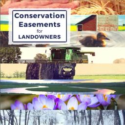
A conservation easement is a voluntary agreement between a landowner and a qualified organization (such as the Legacy Land Trust Society) which limits the amount and type of development that can occur on a property in order to preserve its natural character and agricultural potential.
WellWiki.org is a groundbreaking solution to the problem of information access and transparency related to data on oil and gas development. While in many cases some data on wells is publicly available, interested parties face an arcane and obscure process for accessing it which deters many from pursuing the information they need. WellWiki.org solves this problem, providing access to information in an easy-to-use format available to all, and has been successful across North America. Using WellWiki, Albertans can now access centralized information about any well in the province by searching well name, region, operating company name, municipality, license status, and other details.

The Fort McMurray wildfire affects many people, including landlords and tenants. You may have questions about what the wildfire means for your renting situation.
The Rural Prosperity Initiative is a collaborative programmatic approach to showcasing and implementing sustainability solutions in Alberta’s communities. The Rural Prosperity Initiative is a collaboration between industry, local and provincial governments, non-government organizations and institutions to help communities identify opportunities for waste reduction and repurposing, water reuse, and clean and renewable energy infrastructure upgrades that can save money, attract industry and reduce carbon and GHG.
A study in 2015 found preliminary evidence that in some municipalities in the Calgary region, housing developers are facing challenges when it comes to acquiring licensed water allocations for new housing developments (Nicol & Nicol, 2015). This study explored the issue of water challenges and housing development in more depth. The study focussed on housing development in three of the most water-stressed municipalities in the Calgary region – the municipalities of Rocky View County, M.D. Foothills and the town of Okotoks, and involved personal interviews with 15 housing developers in the region. The study considered four main lines of inquiry: (a) developers’ views of water challenges; (b) the nature and source of the problem; (c) the consequence of water challenges; and (d) solutions. An additional dimension of the study involved a preliminary assessment of the potential impact a decline in housing construction could have on the real estate sector.
Today’s water challenges and opportunities clearly cross many different jurisdictions, stakeholders and communities.
The Newtonian Shift is a facilitated role-playing simulation that allows players to experience decades of energy transition in one day. It features dynamic and fast-paced experiential learning that puts participants in a diverse set of roles: energy producer, private customer, large energy consumer, First Nations, suppliers, grid operator, investors, and government.
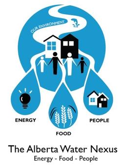
Water is the nexus between food, energy, and people. Water is required to meet the demands of our growing population, to maintain and improve environmental health, and to support the production of food and energy. As the availability of water changes and our population grows meeting the demands in the Nexus will become increasingly challenging.

The Sensitive Habitat Inventory Mapping (SHIM) project for Lac La Biche was initiated in 2016 to respond to community concerns expressed by the Stewards of the Lac La Biche Watershed, over the health of the lake. This project characterizes the physical and biological features of the lake’s foreshore so that sensitive areas can be identified and subsequently protected during shoreline development. The SHIM methodology was developed by Fisheries and Oceans Canada in British Columbia, and while it has been successfully incorporated into land use planning for several lakes there, the Lac La Biche SHIM project will be the first example of its use elsewhere in Canada.